“A terrestrial laser scanner is a geodetic measuring instrument that can be used for the contactless measuring of object surfaces,” says the spokesman for the new research group, Professor Dr.-Ing. Heiner Kuhlmann from the Institute of Geodesy and Geoinformation at the University of Bonn. The measuring instrument emits a laser beam that is reflected by the object and then picked up again. From this, the distance can be determined. Since the laser is movable, the beams can be emitted in different directions. The surface of objects can be “scanned” using a large number of these measurements.
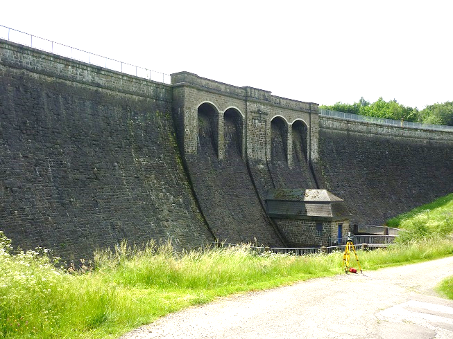
“Defo” stands for “deformation analysis.” This involves determining and evaluating geometric changes to objects. The members of the new research group are particularly interested in bridges and dams. “Both groups of objects are relevant because we are talking about ageing infrastructure,” says the geodesist, who is also spokesperson for the PhenoRob Cluster of Excellence and on the steering committee of the Transdisciplinary Research Area “Sustainable Futures.” Media reports frequently mention the A1 highway and the Leverkusen Rhine Bridge and the A45 highway with the Rahmedetal Bridge. Kuhlmann: “However, it’s believed that there are about 5,000 ‘critical’ bridges in Germany and about 50,000 ‘critical’ dams worldwide.”
Small deformations in advance
Before dams and bridges collapse, small deformations appear. “So if we succeed in detecting these small geometric changes very early on, it’s possible to initiate repair measures in time to avoid closures or total failure,” says the researcher. These “changes” take place in the range of a few millimeters or sometimes even well below that. The deformation analysis therefore evaluates whether these are really changes in the object or a measurement inaccuracy.
“Herein lies the novelty of the research group: For the first time, complete modeling of the measurement uncertainties of the terrestrial laser scanner is performed for use in deformation analysis,” says Kuhlmann. This would provide an objective and efficient measurement method for deformation analysis. “That would certainly be beneficial given the challenges of aging infrastructure.”
In addition to the University of Bonn, the University of Hanover, the Technical University of Vienna, the Technical University of Munich and the Karlsruhe Institute of Technology (KIT) are involved in the project.
Contact:
Prof. Dr.-Ing. Heiner Kuhlmann
Institute of Geodesy and Geoinformation
University of Bonn
Telephone: +49 (0)228 73-2620
E-mail: heiner.kuhlmann@uni-bonn.de


